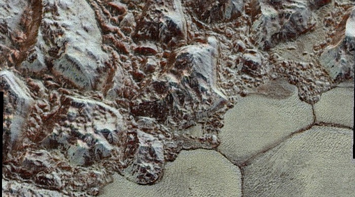
n fact, the pictures are colorful versions of black-and-white images that NASA already showed last week.
“The images form a strip 50 miles (80 kilometers) wide, trending (top to bottom) from the edge of ‘badlands’ northwest of the informally named Sputnik Planum, across the al-Idrisi mountains, onto the shoreline of Pluto’s ‘heart feature, and just into its icy plains,” NASA explained in a press release.
The images combine pictures from the telescopic Long Range Reconnaissance Imager (LORRI) and the Ralph/Multispectral Visible Imaging Camera (MVIC).
The way it works, the LORRI takes photos every three seconds, while the MVIC scans the surface using a very short exposure times to avoid blurring details. NASA mixed images that LORRI took about 15 minutes before New Horizons’ closest approach to Pluto with photos that MVIC gathered 25 minutes prior to the LORRI’s pictures.
“The wide variety of cratered, mountainous and glacial terrains seen here gives scientists and the public alike a breathtaking, super-high-resolution color window into Pluto’s geology,” the agency said.
More images from the July expedition are still coming in, as the spacecraft transmits one to two kilobits of data per second once a week.
More about:


