


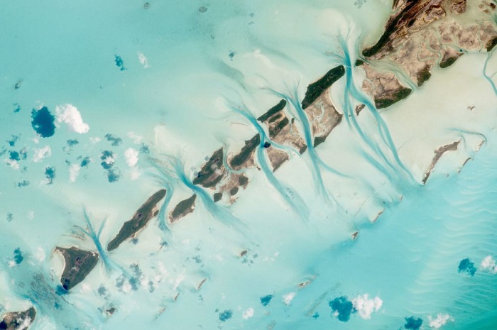
The small island cays and the prominent tidal channels cutting between them in the Bahamas is pictured in this NASA handout photo taken by an astronaut aboard the International Space Station on July 19, 2015.

An aerial view taken on August 14, 2015 shows the saltworks of Berre in southern France.
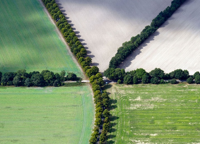
Aerial view shows crossing alleys near Schoenefeld, eastern Germany, on September 4, 2012. The first alleys were planted more than 200 years ago in the federal state Brandenburg.
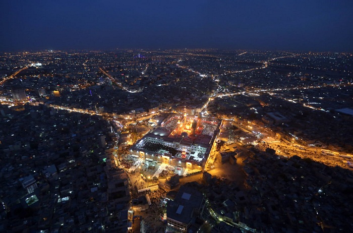
An aerial view of the holy Muslim Shiite shrine of Imam Moussa al-Kazim as pilgrims gather to commemorate his death, in the Shiite district of Kazimiyah, Baghdad, Iraq, Wednesday, May 13, 2015. The anniversary of 8th century Shiite Imam Moussa al- Kazim drew tens of thousands of Shiites from all walks to converge on his golden-domed shrine in northern Baghdad. The pilgrims typically march to the shrine while hundreds of tents are erected to offer them free food, drinks and services.
River Euphrates as seen from above.

Baku, Azerbaijan
In this photo Saturday, Oct. 23, 2010 photo, an aerial view of the reservoir storing chemical waste of Bokod thermal power station, 87 kms northwest of Budapest, Hungary, as an aerial surveillance of reservoirs throughout Hungary is performed in the aftermath of the toxic red mud flood disaster that took place owing to a reservoir dyke break near Kolontar and Devecser on Oct. 4, 2010 when over one million cubic meters of poisonous chemical sludge inundated three villages, killing eight people and injuring over a hundred.
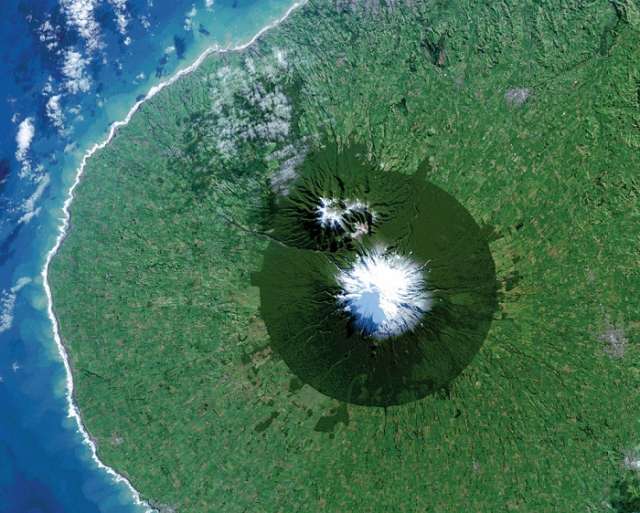
From space, Egmont National Park in New Zealand shows the benefits and limitations of protected areas. In this Landsat 8 image acquired on July 3, 2014, the park, with Mt. Taranaki at its center, was established in 1900. This isolated island of protected forest (dark green areas) is surrounded by once-forested pasturelands (light and brown green).
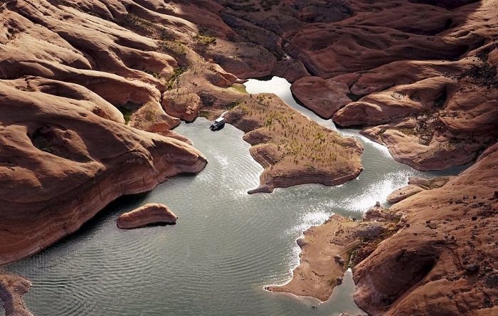
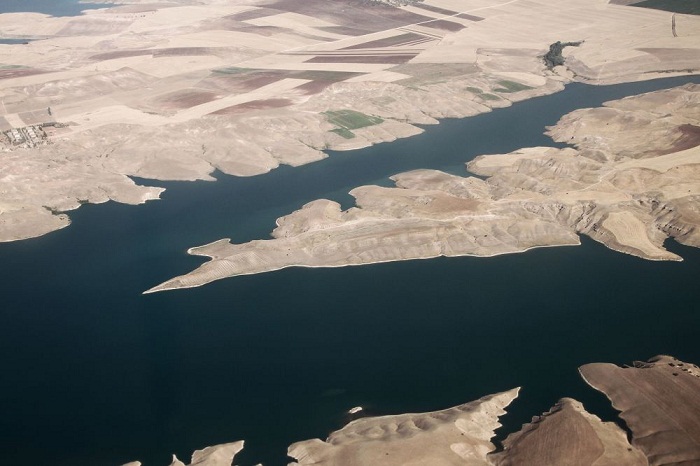
A houseboat camps on the shore in shallow water in a canyon at Lake Powell near Page, Arizona, May 26, 2015. The lake, on the Colorado River provides water for Nevada, Arizona and California. A severe drought in recent years, combined with withdrawals that many believe are not sustainable, has reduced its levels to only about 42 percent of its capacity.
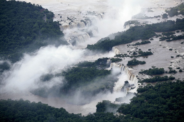
Iguazu falls is seen along the border of Brazil with Argentina, Tuesday, Dec. 15, 2009. The Atlantic Forest, home to the famous Iguazu falls and numerous plant and animal species, is one of the most endangered rainforests in the world.

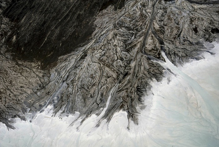
An aerial view taken 19 January 2000 in the Libyan desert near Waw el Kebir shows a crater of the Namous volcano in which appeared a strange geological formation.
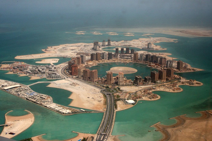
An aerial view shows the pearl Qatar project in Doha, Qatar, Thursday, April 8, 2010.

On July 28, 2015, the Operational Land Imager (OLI) on the Landsat 8 satellite captured images of algal blooms around the Great Lakes, visible as swirls of green in this image of Lake St. Clair and in western Lake Erie. The portion on the left is Detroit, US and its cross-border neighbor, Windsor, Canada.
More about:


-1780923278.jpg&h=190&w=280&zc=1&q=100)


