At least 77 people were killed when multiple wildfires swept across Greece’s Attica region. The death toll is expected to rise as rescue crews search for survivors.
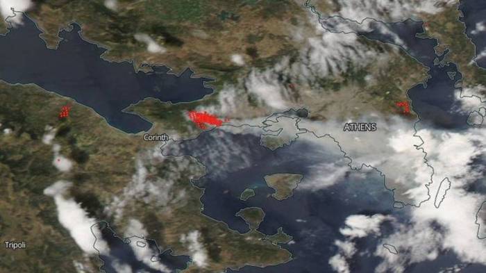
An image captured by NASA on July 24 shows the areas surrounding Athens which are still actively burning.
Two huge fires in Greece have flanked Athens, wreaking havoc in two separate areas outside the capital city. On July 24, our eye in the sky spotted the worst fires to hit Greece in at least a decade.
Meanwhile, aerospace engineer Jorge Garcia examined the spread of nitrogen dioxide from the wildfires – a gas which is toxic if inhaled and which expedites the burning of combustible materials.
RT
More about: NASA


