


The image above is the radar image at about 10:30 am on Wednesday. It shows a large blob of heavy rain bearing down on Adelaide. It`s all very dramatic, but it`s just the beginning of at least two days of meteorological mayhem.
Once the initial deluge passes, the swirling system in the southern ocean is set to strike -- which you can see really clearly on the Bureau of Meteorology`s satellite image. Eek!
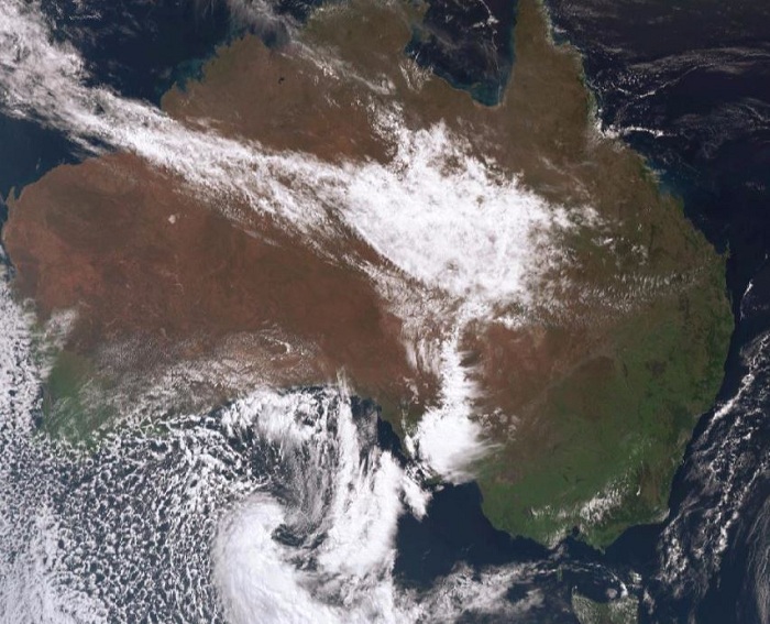
The satellite image shows a deep low pressure system with lots of cloud and loads of cold air. See the speckle behind the swirl? That`s cold, cold air. Adelaide will reach 20 or thereabouts today but just 13 on Thursday.
Melbourne, too, is in for a couple of chilly ones on Thursday and Friday -- although perhaps not as wet as Adelaide.
Heavy snow is forecast for the Australian Alps too ahead of the close of the ski season this Sunday. If forecasts hold true, as much as a metre of snow will fall, and heavy snow could also extend to the Blue Mountains just west of Sydney.
As the above image suggests, the weather systems over the last two weeks have brought lots of rain to inland areas of NSW, VIC and NSW which has been (mostly good news) for farmers.
Inland NSW should also see heavy rain Thursday into Friday, which will likely exacerbate the problems in the state`s Central West, where the town of Forbes has been declared a disaster zone.

And the weekend? Hey, the news is not bad. Things should mostly have cleared up in most areas. AFL grand final day should be cool, but clearing. And it should be a beautiful 27 degrees on Sunday in Sydney for NRL Grand Final day.
Has the weather gone mad? Nope. It`s just spring.
/Huffington Post/
More about:


-1780923278.jpg&h=190&w=280&zc=1&q=100)


