


The new map shows a much better look at the icy continent’s surface features, with a crisp resolution of 2 to 8 meters – compared to the previous standard of 1,000 meters.
The massive 150 terabyte file will provide much more precise information for scientists planning to explore the region.
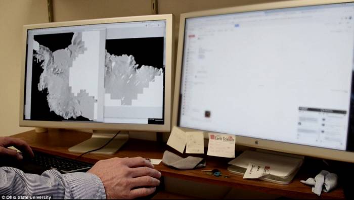
The new map, called the Reference Elevation Model of Antarctica (REMA), was created by scientists at Ohio State University in collaboration with Polar Geospatial Center at the University of Minnesota and the University of Illinois.
‘It is the highest-resolution terrain map by far of any continent,’ said Ian Howat, professor of Earth sciences and director of the Byrd Polar and Climate Research Center at The Ohio State University.
‘Up until now, we’ve had a better map of Mars than we’ve had of Antarctica. Now it is the best-mapped continent.’
According to the researcher, this ultra-precise map could revolutionize how we study Antarctica.
Images of the new map compared to the prior surface imaging show just how dramatic the improvement is.
Where features are pronounced and detailed in the new version, they appear blurred smudges in older maps.
‘At this resolution, you can see almost everything,’ Howat said.
‘We can actually see variations in the snow in some places. We will be able to measure changes in the surface of the continent over time.
‘We will see changes in snow cover, changes in the motion of ice, we will be able to monitor river discharge, flooding, and volcanoes.
‘We will be able to see the thinning of glaciers.’
For the map, researchers used the high-performance Blue Waters supercomputer to process data, using software developed by the team at the Byrd Center to assemble overlapping pairs of satellite images.
The new map, called the Reference Elevation Model of Antarctica (REMA), was created by scientists at Ohio State University in collaboration with Polar Geospatial Center at the University of Minnesota and the University of Illinois
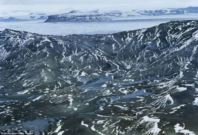
Navigating the treacherous Antarctic terrain is no easy feat. But, with the new map, scientists will have a much better idea of what they’re getting themselves into as they plan excursions to the continent. File photo
‘We had to start from scratch to build this,’ Howat said.
‘The software had to filter data, process it, and turn it into a refined product for the scientific and broader community to use.’
Navigating the treacherous Antarctic terrain is no easy feat.
But, with the new map, scientists will have a much better idea of what they’re getting themselves into as they plan excursions to the continent.
The Daily Mail
More about: Antarctica


-1780923278.jpg&h=190&w=280&zc=1&q=100)


